Guest Blogger: Sarah Dyrdahl
Pre-project Staley Creek Tour with USFS, SWFC, and MFWWC. Spring 2017
Southern Willamette Forest Collaborative Participation: I have been an active member since 2016. I am currently an ex-officio, non-voting board member and I regularly participate on the Implementation Advisory Committee and the Rigdon Collaboration Committee.
Envisioning a Healthy Rigdon Landscape
Rivers and forests where ecosystem processes are preserved with land management, recreation, and other uses. Clean water and abundant fish and wildlife populations. Patch complexity across the landscape where there’s a diversity of habitat types – wild rivers, meadows full of wildflowers and pollinators, fire, healthy forests, and beautiful views.
The Rigdon landscape encompasses four Middle Fork Willamette sub-watersheds south of Oakridge, Oregon. Click the map to the right to enlarge.
Visiting the Rigdon Landscape
Sarah, Audrey Squires (project manager), and Meta Loftsgaarden (executive director of the Oregon Watershed Enhancement Board) tour the post-project Staley Creek floodplain. Spring 2018
I began working for the Middle Fork Willamette Watershed Council in 2015 and the first restoration project we developed was the Staley Creek Floodplain Restoration Project in partnership with the US Forest Service Aquatics Team. We implemented that project in 2017 and began developing the Coal Creek Floodplain Restoration Project, which was implemented in 2019. We’re still working on building the Middle Fork Trail re-route as part of that project and expect it to be completed summer 2020.
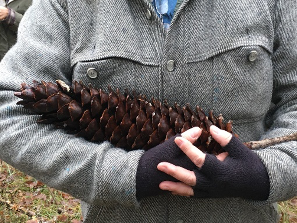
Sugar Pine Cone
Before coming to the Middle Fork, I had never recreated in the Rigdon Landscape, but to do my job well, it’s imperative that I know the watershed intimately. That need led to a crash course in recreating in the Rigdon area, which has been incredible. I’d spent the last 10 or so years working in agricultural landscapes in the mid-Willamette Valley and on the Oregon coast and was instantly drawn to Rigdon because of its feeling of rugged wildness (and limited crowding), as well as forests more reminiscent of where I grew up in southern Oregon. There are even sugar pines which are home to me.
Jims Creek
Changes Throughout the Years
The changes I notice are the active restoration actions that my organization and our partners are responsible for – the two floodplain restoration projects, a trail re-route of the Middle Fork Trail, the burning at Jim’s Creek. Other noticeable changes that aren’t human-caused are new river meanders and the activation of new and different side channels.
Favorite Memory
I can share a least favorite memory! Early in my explorations of Rigdon, I made the mistake of trying to hike the trail from Jim’s Creek to Moon Point in early summer. About ¾ of the way up, my poor dog and I were completely engulfed by voracious mosquitos. I looked like the character Pig Pen from Charlie Brown – but instead of dirt, it was a swarm of mosquitos. My poor dog had a look of remorse on her face. Long sleeves and pants did nothing to mitigate their attack. Instead of hiking as intended, I was running the trail – in hiking boots, with my daypack. It was the most miserable time! We recovered on the Middle Fork Trail where the mosquitos were almost absent.
Favorite Areas
Fall Views from Maple Creek
My favorite area depends on my mood. There are many favorites – the vista and views from the top of Maple Creek in the fall when the Middle Fork and tributaries are a bright gold ribbon of color. (right)
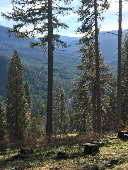
If you squint into the center of this photo, you can see the Coal Creek project. Taken from the top of Jim's Creek.
The uppermost meadow at Jim’s Creek where I can sit on a sunny south-facing slope and see the Coal Creek Floodplain Restoration Project and watch turkey vultures ride the air currents for as long as the daylight lasts. I enjoy the sweet smell of the warm forest on a sunny day. (lower right)
I also enjoy regular, unstructured explorations of the Staley Creek floodplain project – to look at the active changes that are occurring there. Rainstorms offer moments of anticipation and a learning opportunity to understand how the river interacts with and sculpts its floodplain. Grasses, sedges, rushes, and other woody plants are emerging; cobbles, rocks, sands, and logs are sorting; and big, deep pools are forming. Water moves in almost every direction, at varying depths. I don’t often seen critters when I’m out, but know they’ve been there from the beaver chewed sticks to the tiny prints of what I’m betting is a river otter.
Exploring the Staley Creek floodplain post-project
Life after disturbance: native plants come back
Restoration Opportunities
Coal Creek fish rescue crew
I am most excited about a landscape scale restoration vision and approach that pairs upland and floodplain restoration – opening up meadows and dry-mixed conifer forests and using some of that wood to restore nearby rivers and floodplains. Learning how to manage the landscape with fire – both controlled burns and natural ignitions – will be essential. If we can work to reduce fuel loads in the uplands, fire can become our friend, not our foe.
We know this landscape has seen human use and interactions long before white settlers arrived. I envision restoration actions that incorporate and engage the community – where the community has a sense of ownership over the work – and a connection to the place. Community volunteers have worked with us to rescue fish at our floodplain restoration project. Volunteer trail crews cleared and built new sections of the Middle Fork Trail. High school students have helped us imagine interpretive signage. Connecting our community to the land and water is one the most satisfying aspects of my work.
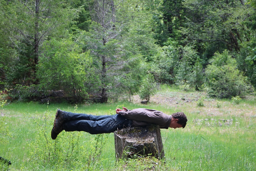
A member of Twin Rivers Charter School finds balance on a Coal Creek pre-project floodplain stump.
A Twin Rivers Charter School student tests out the restored Staley Creek floodplain
A Twin Rivers Charter School student makes temporary art in the floodplain
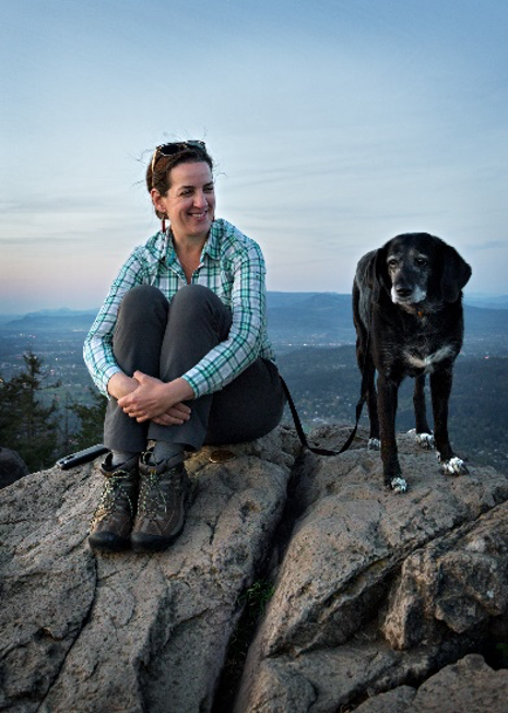
Sarah with her pal Keta.


